Sunday, August 21, 2011

Utah--the rest of it

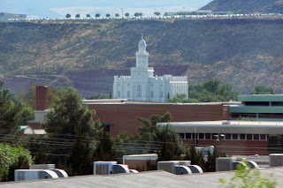
I-15 runs north-south through Utah. Outside of the Utah valley/Salt Lake valley areas, the rest of the state is only lightly populated, and in some parts, the freeway runs on the other side of the mountains from what towns there are. It starts in the south just outside the Virgin River Gorge and runs through red rock areas, then cedar-covered hills, all the way up past the Wasatch and the Great Salt Lake. It runs past Zion's National Park and Kolob Canyon. Starting at the southern end, the first big place you come to is St. George. I wonder about the people who were asked to settle here. Not being a desert girl myself, I think it would have been difficult.


It doesn't take long for cedar trees to spring up (hence the town Cedar City). You can see that the dirt itself is still rather red, though. I believe Kolob Canyon is just on the other side of the gap in the mountains in the first picture.


Provo and Salt Lake are 40 miles apart, and between them is one continuous string of settlement. You may have seen this place in the film Footloose; it's Lehi. (Unlike the characters in movie, however, Mormons do dance.)


Past Lehi is Point of the Mountain, which used to be sort of desolated, only now it's the junction between the two valleys, populationwise. But no matter how many lanes they add to the freeway, people continue to hang-glide in this area. The updrafts must be good.


Around Ogden, the northern arm of the Great Salt Lake gets close to the freeway. The thing is huge! There's a wild bird refuge there, too.


Tremonten is the last town on 15 before Idaho. Here, you can stay on 15 through Idaho towards Montana, or split to the west for Boise. The gap in the mountains is I think a pass to get to Logan (Utah) and Cache Valley.


I-70 starts in the middle of Utah and runs east. It gets near Canyonlands, I think. Utah was settled by Mormons and miners, and it's always very obvious which sort of town it is when you drive through. (The Mormon towns are surrounded by lush, irrigated fields and planned streets and houses; the miner towns are dusty, deserty, and have interesting-looking old machinery up in the hills.)


I-80 also runs through the state and runs west-east. It goes through Salt Lake City and comes out in Wyoming.

Saturday, August 20, 2011

Utah--Salt Lake area

Before there were people, Lake Bonneville covered a good part of Utah, as well as parts of Idaho and Nevada. Then it shrank down to what is today the Great Salt Lake, which is less salty than the Dead Sea, but pretty much saltier than anything else. To the east is the Wasatch front of the Rocky Mountains, and to the west is...well, lots of nothing. Salt flats. If you drive I-80, you will see miles and miles and MILES of this. It's really quite amazing. (Please pull over and rest if it is too hypnotic, however.)


In 1849, Mormon settlers fleeing mob persecution in Illinois chose the Salt Lake valley to settle in. They figured no one else would want to live there, as it was pretty much barren and isolated. But they made it grow, and now it's basically huge. It's home to the University of Utah, as well as of course the worldwide headquarters of the Church of Jesus Christ of Latter-day Saints.


Some things you might see in Salt Lake:

The LDS conference center:


The Salt Lake temple, which took 40 years to build.


Only members in good standing can enter, as it's considered a holy place, but there is a very nice visitor's center, and anyone (LDS or not) is welcome there and on the temple grounds. There is a facsimile of the famous Danish Christus statue in the visitor's center.


There are a lot of interesting, historic homes downtown, like this one (which I believe is a reception center now?)


The freeways have expanded considerably in the past twenty years, so that now they are starting to remind me of Los Angeles. At least, they have that many lanes nowadays, especially as all cities are lined up more or less along I-15/the Wasatch front. Here are some things you can see outside your window as you cruise up the freeway:

Utah--Provo area

Utah is a fascinating state. There are tons of national parks, there is desert, there are mountains, deep canyons, pancake-flat prairies, forests, and grassland. There is the unbeatable strangeness of the Great Salt Lake. There are the remnants of ancient shorelines (Lake Bonneville), where people now view as prime real estate. There is the exploding population of the Salt Lake and Utah valleys, and then there are miles and miles of nothing. Really, you can't go wrong in Utah. There's something for everyone.

This post is the area around Provo (home of Brigham Young University and Utah Valley State University). It has four seasons and isn't too humid (which makes both winter and summer nice). This is a really rapidly growing area, with plenty of university culture plus tons of outdoor sports and activities to enjoy. The population sits up against the Wasatch mountains, and overlooks Utah Lake, which is pretty much wide and shallow and not easy to get to, actually. On the other side of the lake is the unfortunate Nutty Putty Cave, which is also no longer accessible. (Due to a recent tragic death, the cave was sealed.) But there are ice caves up on Mt. Timpanogos, and you can also climb the whole 11,749 feet of that, of course. You climb to the top (rather steep and very long) and then slide down the glacier on the other side.

Timpanogos:


BYU. (Apparently they were going to spell out all three letters on the mountain above the school, but got the Y up there and decided that was enough. Now it is sometimes called the Y--as opposed to the U, which would be the University of Utah up in Salt Lake):


The original Brigham Young Academy, which eventually evolved into the modern university. After spending decades as a condemned building/"haunted house"/hangout spot for vandalists, it was restored to become the city library. Well worth a visit. Oh, and if you pick up Shannon and Dean Hale's book Calamity Jack, illustrated by Nathan Hale (no relation), you will also see it featured on the top of page 21. Just saying. :)


The Provo LDS temple at the mouth of Rock Canyon:


Another notable building in Provo burned down in December 2010: the Provo Tabernacle (see here for some really nice photos in and out). As of right now, the turrets are still standing, but the whole site is fenced off and there are supports to keep the thing from falling down. I am still sad whenever I think of this.

If you go up Rock Canyon behind BYU, you can find nice places to rock climb, like the popular spot, The Kitchen (the large, flat, reddish rock):


The rocks themselves are interesting to look at, and it's too steep of a hike. We have taken a stroller on it before, but er, most people do not believe it is stroller-accessible. I guess it depends on the off-road quality of your stroller and how much you want it back afterwards. :)


Near all of this is Provo Canyon (which you have to take to get to the Timpanogos trailhead). There are some nice waterfalls up there. There used to be a restaurant or something at the top, and a cable car to get up there, but it is now gone.