Tuesday, August 28, 2012

Grand Teton National Park


Grand Teton is, to my mind, Aslan's Country. Or Middle Earth. Or any other fantastically beautiful fictional place you can think of--except that Grand Teton is real. It's also sort of a strange park. You can drive through large sections of it without ever passing an entry gate, and the Jackson airport is within the park's boundaries. I think if I lived in Jackson, I would go to the park every day! But I don't, so I go as often as weather and travel over Jackson Pass (10% grade) will allow. The long park road opens in March, and it's still pretty snowy there, as you can see above.

Out on the eastern side of the park, where it's flat and sagebrushy, is what used to be an old Mormon settlement ("Mormon Row") that was bought out by the park service. The farm buildings still remain.


The loneliest outhouse in the world:


The fields are populated by buffalo nowadays instead of farmers:


Traveling north on the outer main road of the park (Hwy 191), you sort of follow the Snake River. If you're at Oxbow Bend, take the turnout. You may be surprised that you have seen this scene before--we've had an Ansel Adams photo on the wall every since we've been married, and were startled to find it before our eyes in living color. The larger mountain on the left is Mt. Moran, named for American landscape painter Thomas Moran, who came along on early explorations to help document this amazing place.


Keep going north and you'll come to Jackson Lake. The color of the lake is every childhood dream of summer and water and cool blue ice cream:


Now take the inner road (Teton Park Rd) back toward Jackson. If you go up on Signal Mountain, you'll get a good view of what the surrounding landscape is like:


As you follow Teton Park road south, you'll pass a series of lakes. The smallest one is String Lake. There's a very nice, 3-mile hike around the lake that gives you a great side view of the Teton group:


The way is forested and if you go in the right time of year (August/September), there are wild huckleberries along the way. They have not been domesticated, so you enjoy them when you can. They look like tiny blueberries, with a similar but much stronger flavor, and they have a perfect bull's eye on the end. The shrubs are about two feet high and they like to cover forest hillsides. Y.U.M.


Forest path around String Lake:


String Lake is popular for kayaks and other small boats. It has a swimming area, too, which is refreshing after a summer hike. The water is clear and only about three feet deep at its deepest, so it's pretty warm. Large boulders in the middle make fun destinations for kids.


As you continue southwards back to Jackson, you'll pass Jenny Lake. Jenny Lake is a pretty popular tourist destination because it's so close to Jackson (and because it's pretty!). You can take a ferry across and hike up Cascade Canyon to see Hidden Falls and then go up to Inspiration Point. If you like, you can hike back down and take the ferry back--or hike around the lake (2 or 3 miles) back to your car. Or, if you're REALLY adventurous, you can keep on hiking the canyon up to Alaska Basin, and then it's only 7.5 miles down the other side to the trailhead of South Fork (Teton Canyon from the Idaho side, near Driggs). Um, but that would be a serious backpacking trip.

Hidden Falls:


Inspiration Point:


As to animals, you can see all kinds in Grand Teton. I've seen black bears in the middle of the day, and grizzlies do live up there, too, so keep your bear spray handy. Handy means in your hand or on a holster, NOT in your pack. And learn how to use it, too, because if you spray it all out when the bear is 50 feet away, you'll have nothing left when he's five feet away. Watch the air currents so he gets it, not you. But you are far less likely to see bears as you are chipmunks and lizards and buffalo and elk and these guys, the yellow-bellied marmot:


And that's Grand Teton! 


Friday, November 18, 2011

Island Park, ID


Island Park is a mostly recreational area of Idaho. Technically it's a town, but it's 20 miles long and about a mile wide. Not many people live there year-round, as the snow pretty much cuts you off from everywhere. In the summer, it's a great place for recreation, though. Near to rivers and lakes and Yellowstone, as well as two state parks (Harriman and Henry's Lake), it's quite beautiful.

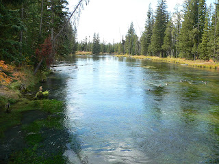
If you turn off by Mack's Inn, you will eventually (4 miles or so?) get to Big Springs, which is where the Henry's Fork of the Snake River starts. It starts suddenly, with a lot of spring water feeding it, and is full of very large trout. The water is clear and green plants grow in it.


A German immigrant named Johnny Sack built a cabin and mill up here. Obviously he was an adventurous sort, because if you live up here, you have to assume you'll be isolated for large stretches of time. Very nice when it's accessible, though!


If you take the Mesa Falls loop down towards Ashton (and civilization), you go through national forest land. Enjoy the rivers and wild animals (in this case, a musk rat)!


If you go down to the populated Snake River valley via highway 20 (ie, the normal route, as the Mesa Falls loop is not plowed in winter, and snow can cover the road by four feet), you'll pass Harriman State Park. It's the remains of a volcanic caldera, and is set up as a park to view wildlife. The endangered trumpeter swan lives here (yes, as in EB White's The Trumpet of the Swan).


Enjoy the river (whose source we saw above), the cattails on Silver Lake, and beautiful wasps' nests (but maybe don't touch!).

Sunday, August 21, 2011

Utah--the rest of it

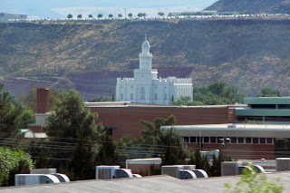
I-15 runs north-south through Utah. Outside of the Utah valley/Salt Lake valley areas, the rest of the state is only lightly populated, and in some parts, the freeway runs on the other side of the mountains from what towns there are. It starts in the south just outside the Virgin River Gorge and runs through red rock areas, then cedar-covered hills, all the way up past the Wasatch and the Great Salt Lake. It runs past Zion's National Park and Kolob Canyon. Starting at the southern end, the first big place you come to is St. George. I wonder about the people who were asked to settle here. Not being a desert girl myself, I think it would have been difficult.


It doesn't take long for cedar trees to spring up (hence the town Cedar City). You can see that the dirt itself is still rather red, though. I believe Kolob Canyon is just on the other side of the gap in the mountains in the first picture.


Provo and Salt Lake are 40 miles apart, and between them is one continuous string of settlement. You may have seen this place in the film Footloose; it's Lehi. (Unlike the characters in movie, however, Mormons do dance.)


Past Lehi is Point of the Mountain, which used to be sort of desolated, only now it's the junction between the two valleys, populationwise. But no matter how many lanes they add to the freeway, people continue to hang-glide in this area. The updrafts must be good.


Around Ogden, the northern arm of the Great Salt Lake gets close to the freeway. The thing is huge! There's a wild bird refuge there, too.


Tremonten is the last town on 15 before Idaho. Here, you can stay on 15 through Idaho towards Montana, or split to the west for Boise. The gap in the mountains is I think a pass to get to Logan (Utah) and Cache Valley.


I-70 starts in the middle of Utah and runs east. It gets near Canyonlands, I think. Utah was settled by Mormons and miners, and it's always very obvious which sort of town it is when you drive through. (The Mormon towns are surrounded by lush, irrigated fields and planned streets and houses; the miner towns are dusty, deserty, and have interesting-looking old machinery up in the hills.)


I-80 also runs through the state and runs west-east. It goes through Salt Lake City and comes out in Wyoming.

Saturday, August 20, 2011

Utah--Salt Lake area

Before there were people, Lake Bonneville covered a good part of Utah, as well as parts of Idaho and Nevada. Then it shrank down to what is today the Great Salt Lake, which is less salty than the Dead Sea, but pretty much saltier than anything else. To the east is the Wasatch front of the Rocky Mountains, and to the west is...well, lots of nothing. Salt flats. If you drive I-80, you will see miles and miles and MILES of this. It's really quite amazing. (Please pull over and rest if it is too hypnotic, however.)


In 1849, Mormon settlers fleeing mob persecution in Illinois chose the Salt Lake valley to settle in. They figured no one else would want to live there, as it was pretty much barren and isolated. But they made it grow, and now it's basically huge. It's home to the University of Utah, as well as of course the worldwide headquarters of the Church of Jesus Christ of Latter-day Saints.


Some things you might see in Salt Lake:

The LDS conference center:


The Salt Lake temple, which took 40 years to build.


Only members in good standing can enter, as it's considered a holy place, but there is a very nice visitor's center, and anyone (LDS or not) is welcome there and on the temple grounds. There is a facsimile of the famous Danish Christus statue in the visitor's center.


There are a lot of interesting, historic homes downtown, like this one (which I believe is a reception center now?)


The freeways have expanded considerably in the past twenty years, so that now they are starting to remind me of Los Angeles. At least, they have that many lanes nowadays, especially as all cities are lined up more or less along I-15/the Wasatch front. Here are some things you can see outside your window as you cruise up the freeway: